Protected Area
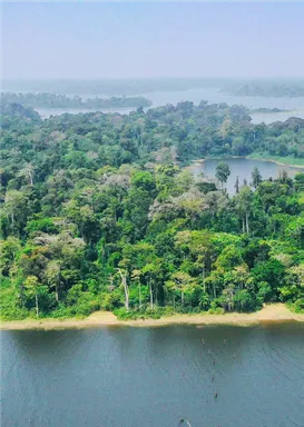
Taï National Park
- Presentation of the Taï National Park (source: Taï National Park Development and Management Plan 2020 — 2029)
Administrative and geographical situation
The Taï National Park (PNT) and the N'ZO Partial Wildlife Reserve (RPFN) constitute a forest block that covers an area of 536,016 ha. This complex is part of the network of protected areas in Côte d'Ivoire (Figure 1), of which it represents 25% of the total area.
It is located in the southwest of Côte d'Ivoire in the Cavally-Sassandra interfluve between latitudes 5°08' and 6°24' North and the longitudes 6°47' and 7°25' West.
According to the last administrative division in 2013, the PNT extends over three (3) Regions (Cavally, Nawa and San Pedro), six (6) Departments (Guiglo, Taï, Buyo, Méagui, San Pedro and Tabou) and eleven (11) Sub-prefectures (Guiglo, Nizahon, Nawa and San Pedro), six (6) Departments (Guiglo, Taï, Buyo, Méagui, San Pedro and Tabou) and eleven (11) Sub-prefectures (Guiglo, Nizahon, Taï, Zagné, Buyo, Méagui, San Pedro and Tabou) and eleven (11) Sub-prefectures (Guiglo, Nizahon, Taï, Zagné, Buyo, Méagui, San Pedro and Tabou) and eleven (11) Sub-Doba, Dogbo, Dogbo and Djouroutou).
History
The Taï National Park takes its name from the city of Taï, a locality located between its western limit and the Cavally River, the natural border of Côte d'Ivoire with Liberia. The history of its creation began in 1926 with the colonial administration which created the “Refuge Park of the Middle and Lower Cavally Forest Region” by decree No. 2508/AG/11/04/1926 (Riezebos et al., 1994) with an area of 960,000 ha.
After several evolutions, it became, by decree of August 07, 1956, an Integral Reserve for the fauna and flora of Taï, the central and southern parts of which were established as “Taï National Park” by decree No. 72-544 of August 28, 1972 and the northern part into the “Nzo Partial Fauna Reserve” by decree No. 72-545 of August 28, 1972. The respective areas are then 350,000 ha and 75,000 ha.
In 1973, the park was amputated by an area of 20,000 hectares in favor of the N'zo Wildlife Reserve by decree No. 73-132 of 21 March 1973.
In 1977, a peripheral protection zone for the Taï National Park with an area of 96,000 ha was created in the west and north-east by Decree No. 77-348 of June 3, 1977.
In 1983, a protection and development zone of approximately 18,000 ha was created between the Taï National Park and the paper mill area by MINEFOR decree No. 9 of 11 May 1983.
Later, pursuant to article 9 of Law 2002-102 of 11 February 2002 on the establishment, management and financing of national parks and natural reserves, amended in article 2 by Law No. 2013-864 of 23 December 2013, the following two decrees were issued:
- Decree No. 2018-495 of 23 May 2018 modifying the boundaries of the N'zo Partial Wildlife Reserve in order to reduce it in favor of the PNT (annex 1a);
- Decree No. 2018-496 of 23 May 2018 modifying the boundaries of the Taï National Park in order to extend its area to the peripheral protection zone and to part of the N'zo Wildlife Reserve (annex 1b).
These two decrees definitively fix the area of Taï National Park at 508,186 ha and that of the N'zo Partial Wildlife Reserve at 27,830 ha, making this massif the largest forest block in the Guinean domain under protection status with an overall area2 of 536,016 ha (according to Decrees No. 2018-495 and 496 of May 23, 2018). Figure 3 below shows the evolution of the boundaries of the Taï and N'zo forest complex.
At the international level, thanks to the efforts made by its Management and its partners at the time, the park was admitted to the global network of Biosphere Reserves in 1978 and registered on the list of natural UNESCO World Heritage sites in 1982.
Published on
2022 Apr 21Countries

Côte d'Ivoire